Trailseek
Quick start
Get moving in a few minutes.
Open the app
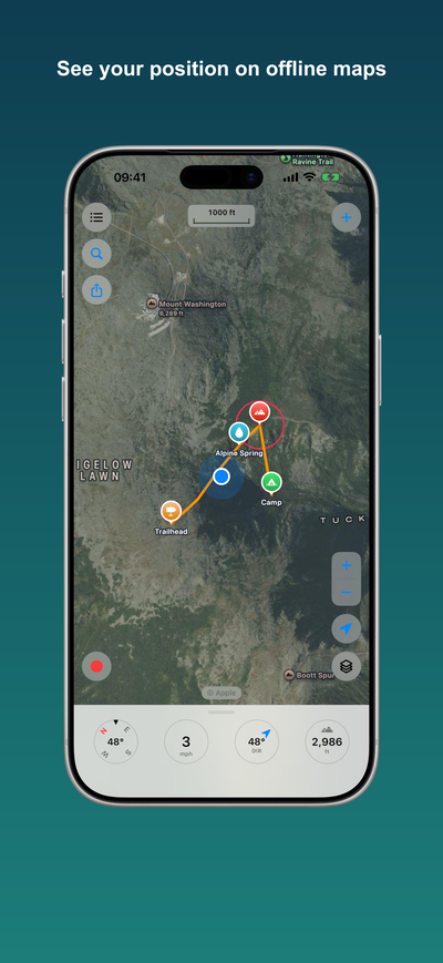
On first launch Trailseek asks for location access. Allow it, and the map centers on you as a blue dot. The map follows you as you move. Pan the map to stop following, and tap the locate button to recenter. The locate button also cycles through follow, follow with heading up, and free.
Switch the map
Tap the layers button to pick a map style: Apple Maps, Satellite, Hybrid, Muted, OpenStreetMap, OpenTopoMap, or USGS Topo. Turn on 3D terrain for hill relief on the Apple styles. See Maps and layers.
Drop a waypoint
Tap the plus button to drop a waypoint at the center of the map, or long-press anywhere on the map. Open it to rename it, choose an icon and color, add a note, or attach a photo. See Waypoints.
Record a track
Tap Record to start a track. A pill shows time, distance, and speed while the line draws on the map. Pause or stop when you are done, then name and save it. Recording keeps going with the screen off if you allow background location. See Tracks.
Read your position
Pull up the panel at the bottom of the screen for a full readout: latitude and longitude, MGRS and UTM, elevation, speed, and GPS accuracy. Tap a value to copy it. See Coordinates and grids.
Go offline
Download a map region before you lose signal so it keeps working with no connection. See Offline maps.