Trailseek
Coordinates and grids
The status panel
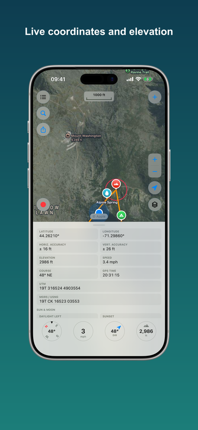
Pull up the panel at the bottom of the map for a live readout: latitude and longitude, UTM, MGRS or USNG, elevation, speed, course, GPS accuracy, and the fix time. Tap any value to copy it. Tapping latitude or longitude copies the pair.
Coordinate formats
Latitude and longitude appear in one of three formats. Change it in Settings, or long-press the coordinates: - Decimal degrees - Degrees and decimal minutes - Degrees, minutes, seconds
The status panel also shows MGRS or USNG and UTM. Your choice applies everywhere latitude and longitude appear.
Grid overlay
Turn on a coordinate grid to draw a lat/long graticule or a UTM grid with MGRS labels over the map. The grid is computed on the device and works offline. See Overlays.